Living in Burlingame: two downtowns, leafy streets, and a strong sense of place
Burlingame is one of the Peninsula cities whose identity becomes clearer the more time you spend on its streets. Its central neighborhoods are shaded by mature trees and shaped by homes from different architectural eras. Its commercial life revolves around two distinctly different destinations: the busier, longer stretch of Burlingame Avenue and the more compact Broadway district to the north. Beyond them, residential roads climb toward open-space canyons and hillside neighborhoods, while the city extends east across Highway 101 toward San Francisco Bay.
Daily life moves among those settings. A weekend might include a farmers' market visit, a walk past the historic train station, lunch with friends on Burlingame Avenue, and an afternoon at Washington Park. Another day might begin on a hillside trail at Mills Canyon or with a short stop at the stores on Broadway. The same city offers compact blocks near shops and Caltrain, established single-family streets, apartments and condominiums, and homes where slope and views change the relationship between rooms and gardens.
Burlingame's appeal is not simply its location between San Francisco and Silicon Valley. Its history, urban forest, local institutions, and housing stock give neighborhoods identities that do not disappear at the city boundary. Understanding how each part developed helps explain why a house near Broadway does not feel like one near downtown, and why a low-profile home in Mills Estates can be architecturally different from a period house in Easton Addition.
A history of estates, railroads, and the City of Trees
Long before the city existed, this part of the Peninsula was home to Indigenous Ohlone communities. In the nineteenth century, land associated with Rancho Buri Buri and later large private estates shaped the area. The Howard family, the Easton family, and other estate owners left traces in place names and street patterns. The city also takes its name from Anson Burlingame, the American diplomat and former U.S. minister to China, who acquired land in the area during the 1860s.
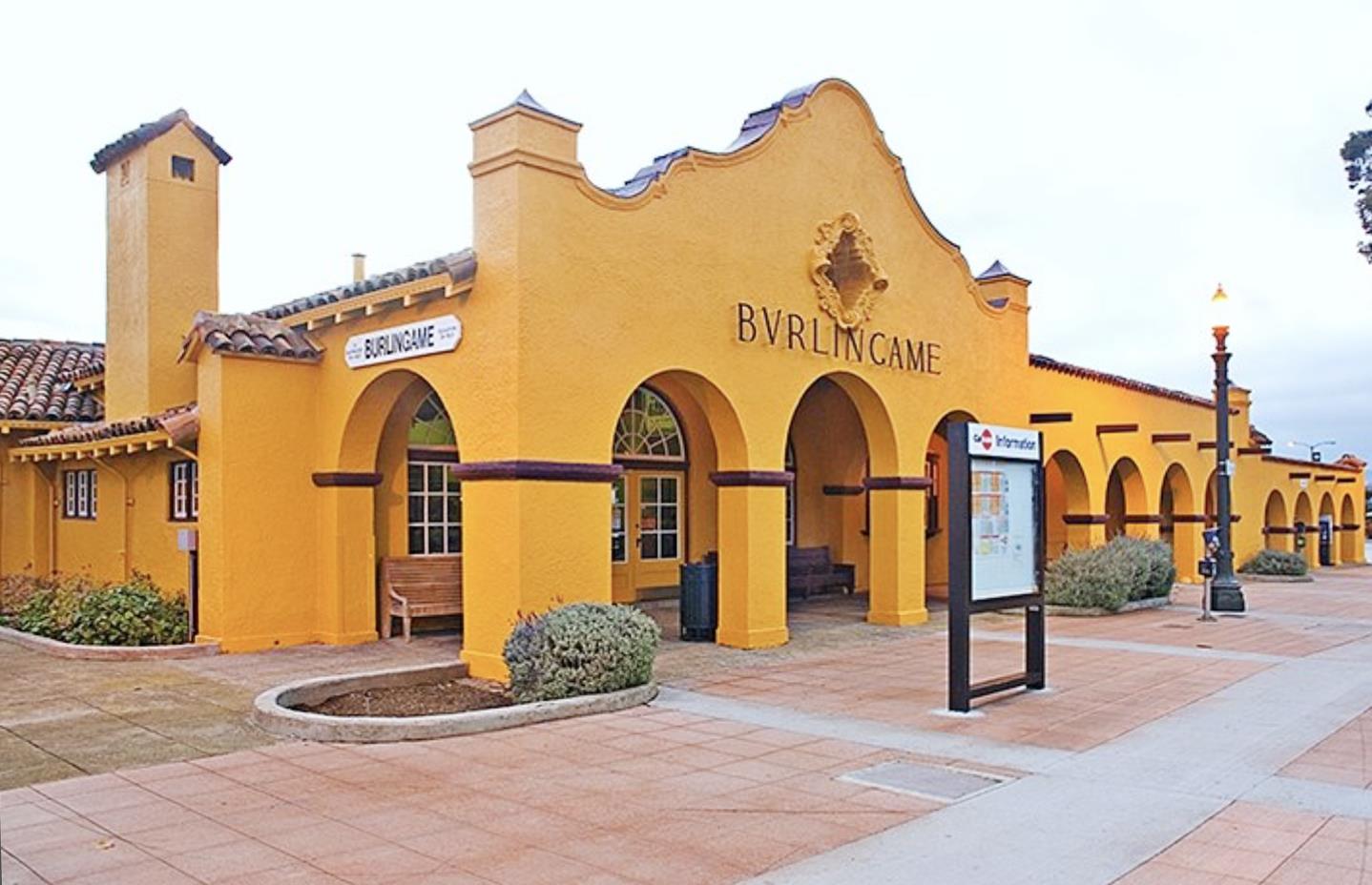
The railroad helped turn estate country into a permanent town. Burlingame's station opened in 1894, its Mission Revival architecture making it a landmark in its own right. The building's tower, arched details, and historic roof design are more than a nostalgic backdrop; they show how architecture was used to give an emerging community a public identity. Burlingame incorporated in 1908, and the neighboring Easton area was annexed soon after.
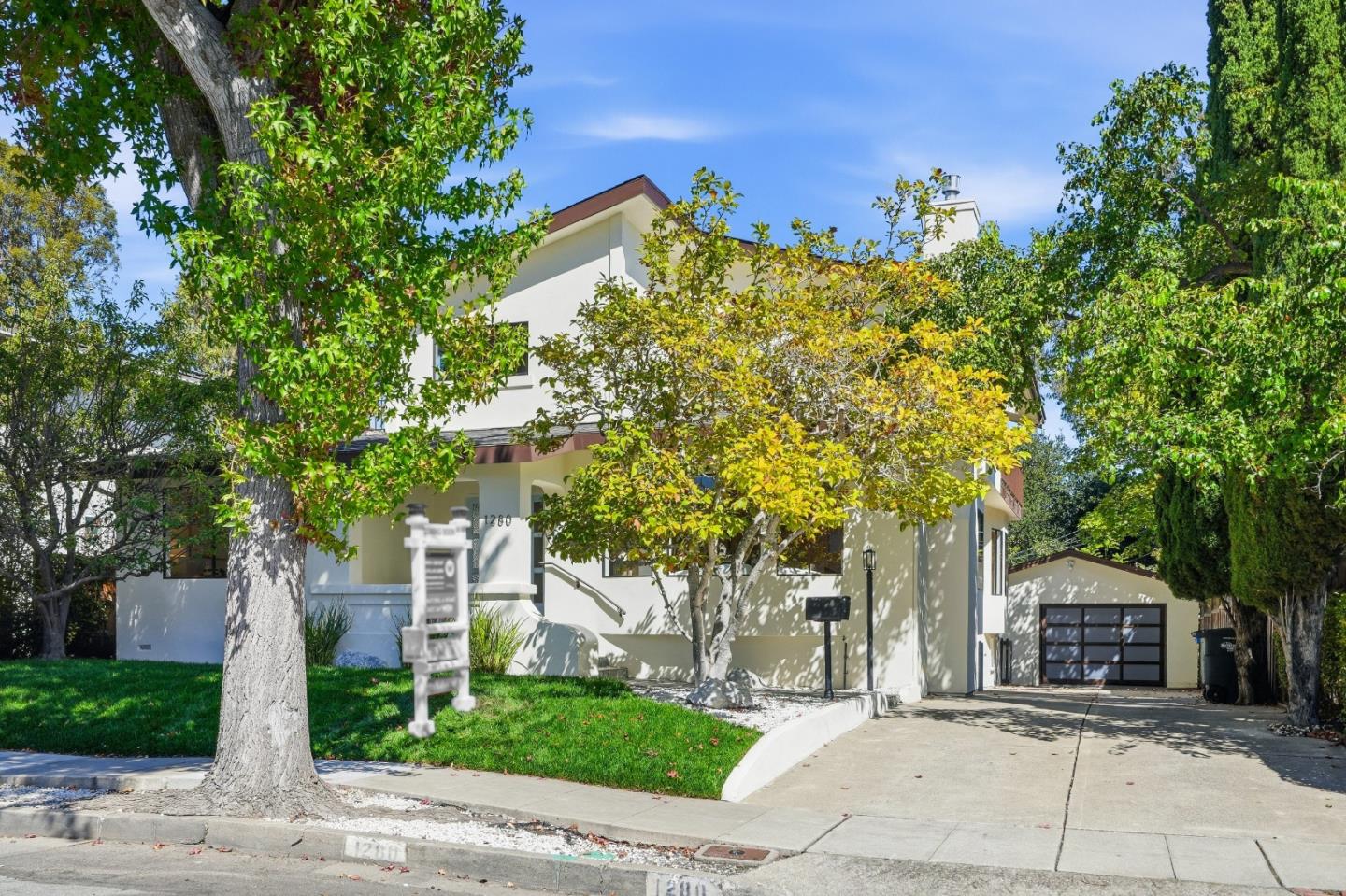
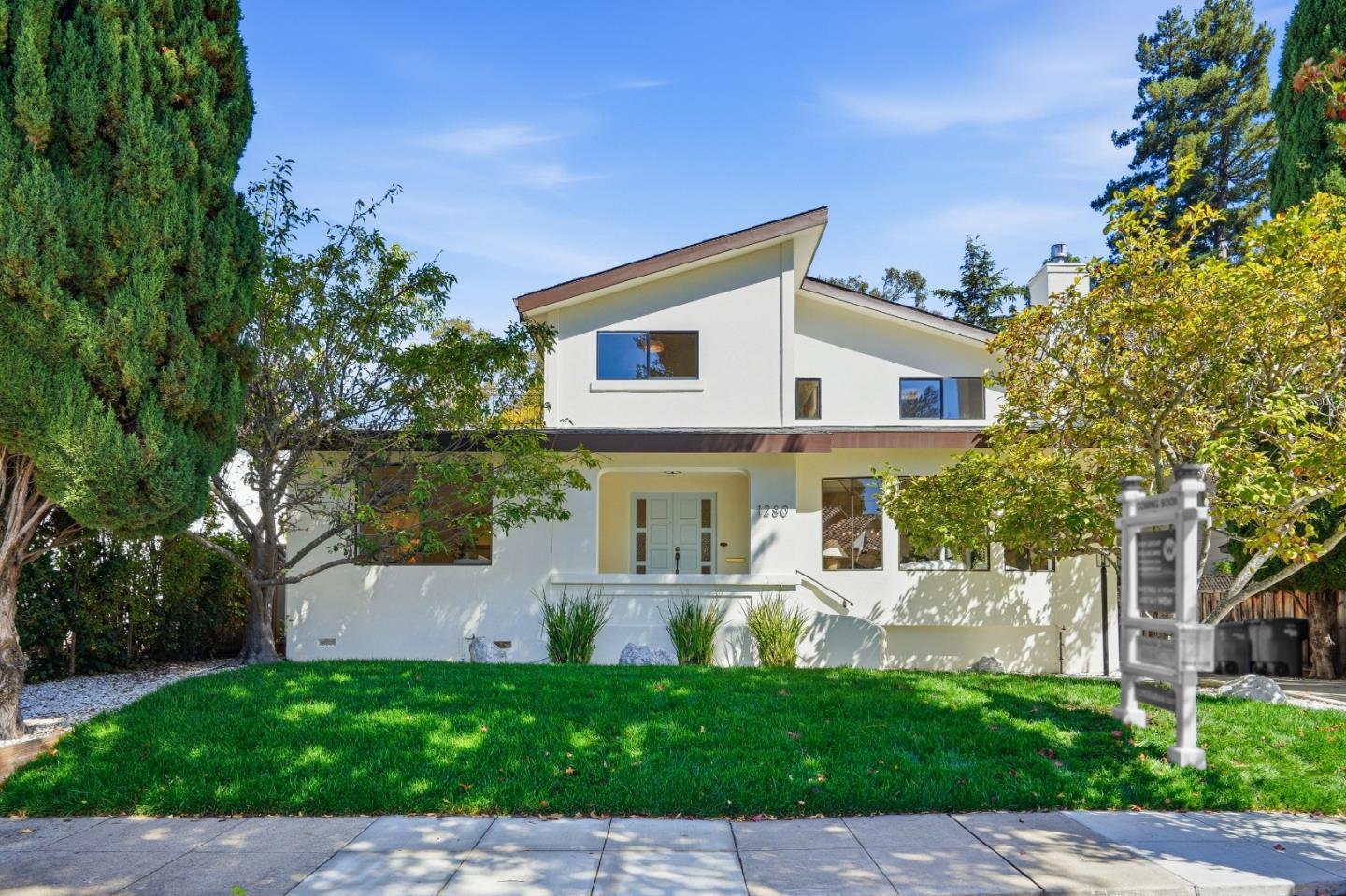
The 1906 San Francisco earthquake and fires encouraged more residents to settle along the Peninsula. Early subdivisions spread around the rail corridor, and later decades brought homes that reflected changing design tastes and the expansion of suburban life. The city now contains Craftsman and Spanish-influenced houses, traditional revival styles, postwar ranch homes, hillside split-levels, and contemporary replacements. These layers are visible block by block instead of being confined to one historic district.
Burlingame's nickname, the City of Trees, also has a real landscape history. The Howard–Ralston tree rows along El Camino Real were planted in the 1870s, initially with elms and eucalyptus used to protect young trees from wind. Today the historic rows, neighborhood trees, and park landscapes remain important elements of the city's character. Trees add shade and texture, but their long-term care—roots, canopy, safety, and infrastructure—is part of a changing urban environment.
A closer look at Burlingame's neighborhoods
Burlingame is best understood as a set of places with different histories, building patterns, and relationships to downtown or the hills. Community names such as Easton Addition, Burlingame Park, Ray Park, and Burlingame Hills are commonly used, while mapping systems and real estate reporting boundaries sometimes combine or divide them differently. The following descriptions focus on recognizable character rather than suggesting that every house within a label looks or lives the same way.
Easton Addition: architectural variety and established streets
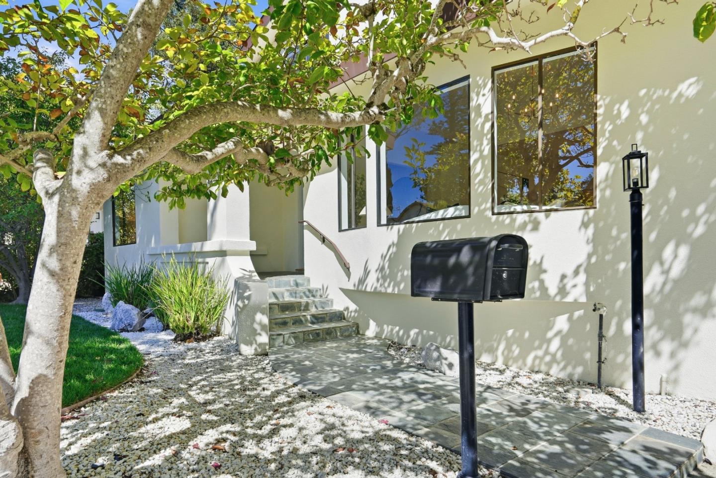
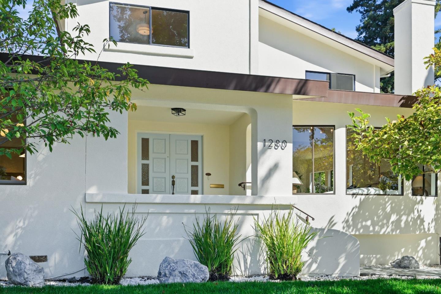
Easton Addition occupies a central place in Burlingame's early residential history. The name comes from the Easton family's former estate and the subdivisions that followed. Many streets have a distinctly traditional feel, with mature landscaping, sidewalks, and houses showing the design vocabulary of the early twentieth century. Craftsman details, stucco façades, pitched roofs, entry porches, and later period-inspired homes can appear within a short walk of one another.
The visual rhythm of the neighborhood often comes from the combination of rooflines, front gardens, windows, and the proportion of a house to its lot. Some homes have been carefully updated behind their original façades; others have undergone substantial additions or replacement construction. That architectural variety makes the neighborhood interesting to explore even without a destination. It also means the relationship between a new design and its neighboring buildings can be as important as the interior finish.
Easton Addition stretches across different positions relative to Broadway, El Camino Real, and the western residential areas, so everyday access varies within the name. The historic subdivision story unifies it, but one address may be much closer to a café or train platform while another feels more removed from commercial activity.
Burlingame Park: early residential character near downtown
Burlingame Park reflects another chapter of the city's original estate and subdivision era. Its established streets and older homes give it a different architectural atmosphere from later postwar neighborhoods. Traditional designs, mature trees, garden setbacks, and individual houses of varying scale contribute to the sense that the neighborhood grew over time rather than arriving as a single uniform development.
Its location in the broader downtown area places parks, schools, and the Burlingame Avenue district within the everyday geography of many residents, although distances and walking conditions are specific to each block. Washington Park and the civic facilities near it provide a particularly important point of reference. As with other historic neighborhoods, restoration, renovation, and new construction may look very different from property to property.
Burlingame Terrace and Burlingame Gardens: close to the city's two commercial districts
Burlingame Terrace and Burlingame Gardens contribute to the more compact and accessible residential fabric around the central and northern commercial corridors. The mix of houses, apartments, and remodeled properties differs from the spacious, view-oriented hillside settings. Residential blocks connect to places where errands, restaurants, and everyday services are part of the neighborhood rather than a separate trip across town.
Burlingame Gardens has a particularly strong relationship with the Broadway area. Some streets feel sheltered and residential even though the commercial district is close by; others are more directly affected by traffic and transportation routes. Burlingame Terrace, nearer the central city, contains its own combinations of older housing, small-scale streets, and later alterations. The experience of a home near a train line or major road can be quite different from that of a home only a few blocks away.
Ray Park, Burlingame Village, and Burlingame Gate: northern neighborhood routines
In northern Burlingame, Ray Park, Burlingame Village, and Burlingame Gate are useful neighborhood references, each with its own street layout and relationship to schools, shops, and open spaces. Here the city includes many twentieth-century houses, properties updated in phases, and streets where a familiar park or neighborhood commercial area becomes the center of daily routines. The architecture is not one single style, and it is worth noticing roof forms, additions, setbacks, and how private gardens meet the street.
Ray Park itself anchors an active outdoor scene with playground space, courts, playing areas, and places to gather. Village Park, nearer California Drive, is another neighborhood-scale destination with a preschool program and casual recreational space. A home may be close to one of these parks yet have a very different route to Broadway or a rail stop. These small differences help define neighborhood life without reducing it to a commute calculation.
Burlingame Hills and Mills Estates: mid-century houses and the western landscape
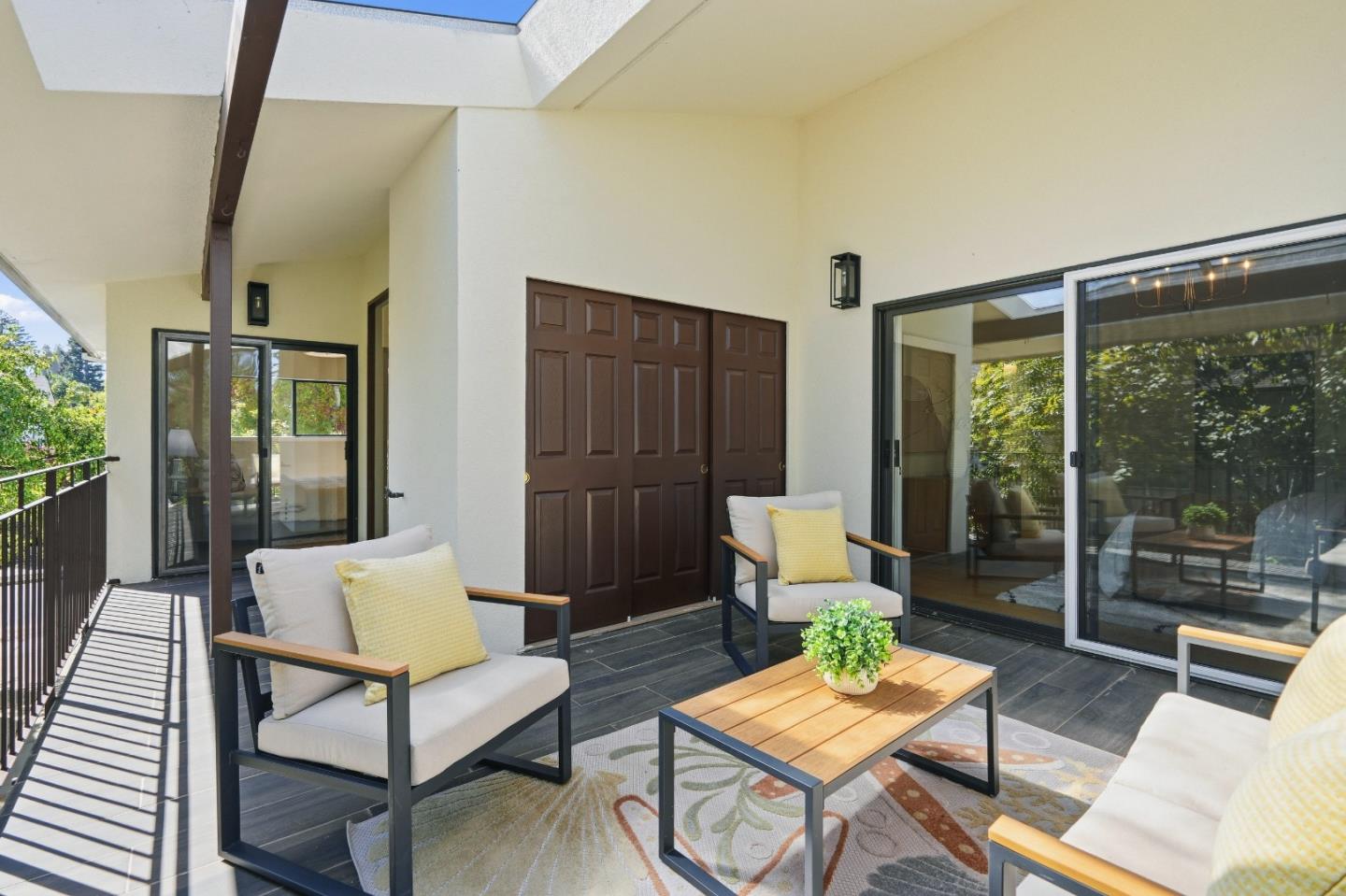
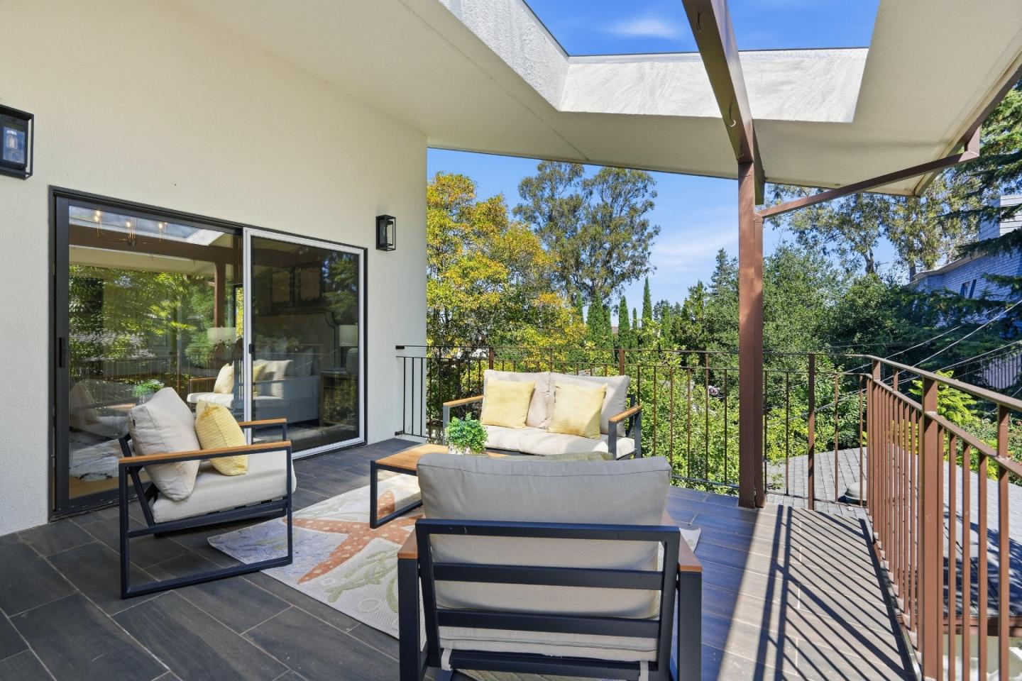
The western hills reveal a different side of Burlingame. Burlingame Hills and Mills Estates include postwar residential landscapes with ranch houses, split levels, and some homes showing Eichler-influenced design. Roof pitches, window placement, exposed beams, and the relationship between interior living spaces and outdoor terraces often tell a mid-century architectural story. Remodels and larger replacements add another layer of change.
Topography matters here. A road can rise and curve, entrances may meet a sloped site at different levels, and sunlight or views depend strongly on orientation. Gardens may occupy a single level, a terrace, or several connected areas. Retaining walls, drainage, trees, garage placement, and the accessibility of outdoor space all influence how a property works. The size of a lot alone cannot fully describe the everyday experience of a hillside home.
Mills Canyon Wildlife Area, Cuernavaca Park, and western parkland help define the nearby recreational geography. The hills can feel far from the commercial bustle even though downtown and regional routes remain part of the same city. Millbrae also has a neighborhood called Mills Estates, so city limits and individual property locations should be checked rather than assuming a shared neighborhood name identifies one jurisdiction.
Lyon Hoag, Oak Grove Manor, and the neighborhoods around the rail corridor
The southeastern and central neighborhoods known as Lyon Hoag and Oak Grove Manor show Burlingame's relationship with its older grid, the railroad, and nearby civic and commercial destinations. A mix of property ages and housing types creates a more varied scale than the largely detached-home sections of the western hills. Around the rail corridor and the station, the ability to reach downtown on foot can be part of the appeal of everyday life.
The closeness of these districts to commercial activity also introduces practical differences in sound, street parking, and pedestrian traffic. One tree-shaded residential block can feel calm while a nearby street plays an important role in regional movement. Rather than making blanket assumptions, each area is best understood by the way its homes and shared public spaces meet actual roads and destinations.
Downtown and Burlingame Square: life around the historic station
Downtown is not just a shopping address. Its blocks combine historic commercial buildings, restaurants, civic destinations, offices, apartments, and other housing close to the Burlingame station. Burlingame Square and the historic depot connect today's daily routines to the town's railroad origins. The station building itself is an architectural landmark, while the streets leading toward Burlingame Avenue reflect the older pattern of a compact commercial center.
For some residents, this is the pleasure of living where a coffee shop, a library visit, a train platform, and an evening meal can fit into the same walk. For others, nearby activity, parking patterns, and smaller homes are trade-offs worth considering. The neighborhood's defining feature is the relationship between the home and its public setting—not a particular house size or price band.
Two distinct main streets: Burlingame Avenue and Broadway
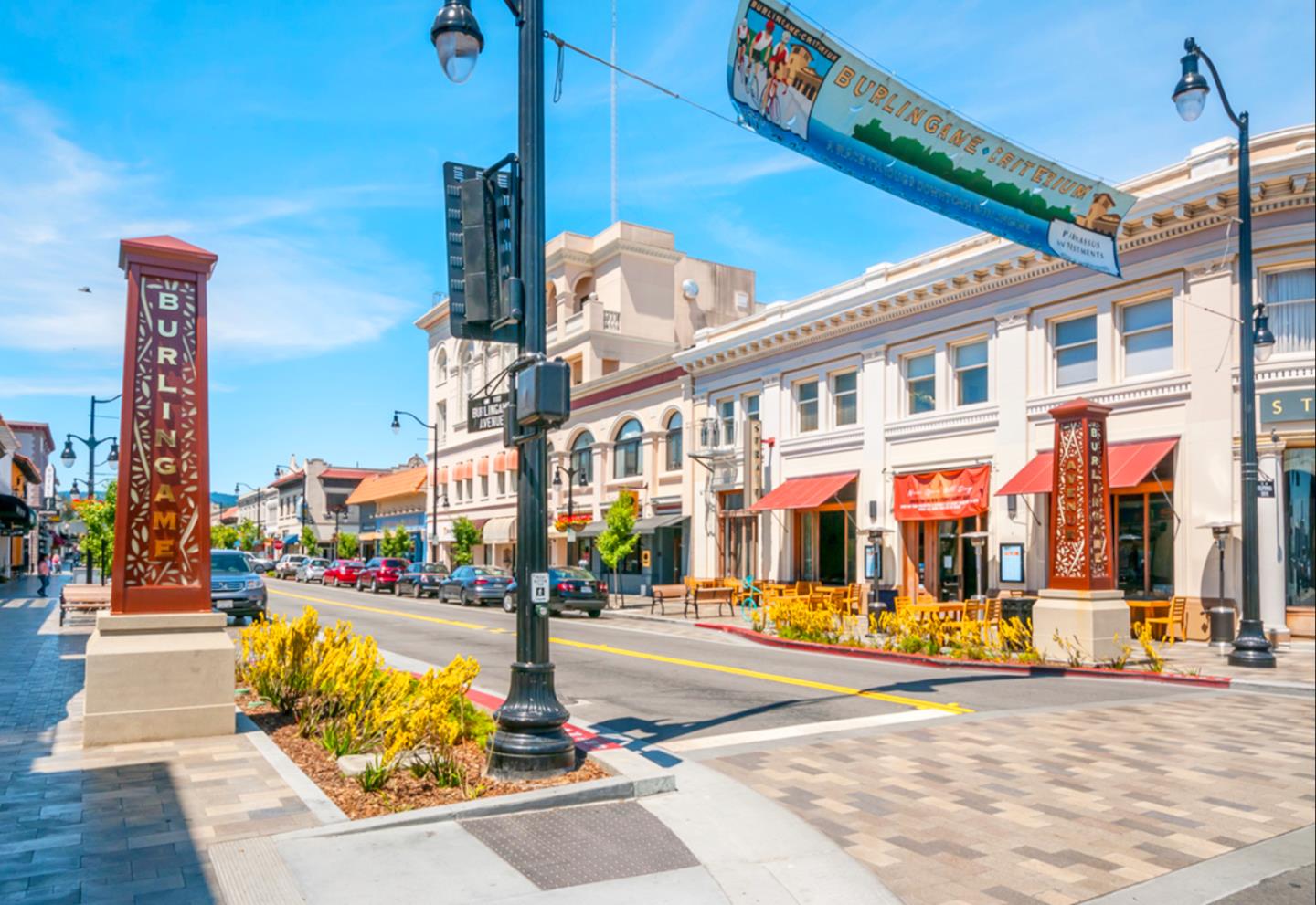
Burlingame Avenue is the city's principal downtown destination. Between California Drive and El Camino Real, it brings together cafés, restaurants, independent shops, national brands, and streets that invite browsing. Its historic commercial buildings, broad sidewalks, and outdoor seating create a more animated setting than many conventional suburban shopping centers. The neighboring streets add more dining, services, and everyday errands, while the library and Washington Park extend the experience beyond retail.
Broadway is different by design and by feeling. Its shorter stretch between California Drive and El Camino Real is more of a neighborhood main street: restaurants, bakeries, smaller shops, local services, and familiar storefronts. The historic Broadway arch gives the district a recognizable entrance, and its connection to Easton-era development is part of the city's own history. Broadway is not a smaller copy of Burlingame Avenue; it has a more intimate pace and serves a different collection of nearby residential streets.
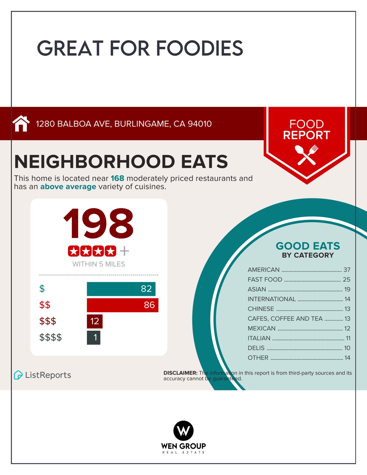
Burlingame Plaza provides another practical shopping point in the city's north, while the Bayfront supports hotels and restaurants serving visitors as well as residents. Food choices are varied across town, from casual neighborhood breakfasts and cafés to international dining and more formal evenings out. Specific restaurants come and go, but the value of having two established, walkable commercial districts is part of what makes Burlingame's local life distinctive.
The Burlingame Fresh Market brings produce and other market goods into the downtown routine, with a year-round Sunday market and seasonal weekday hours according to the county's published listing. Local street events and community programming also make downtown a gathering place, not only a place to shop. Schedules and participating vendors should be checked as they change.
Parks, trails, and the difference between hillside and bayfront
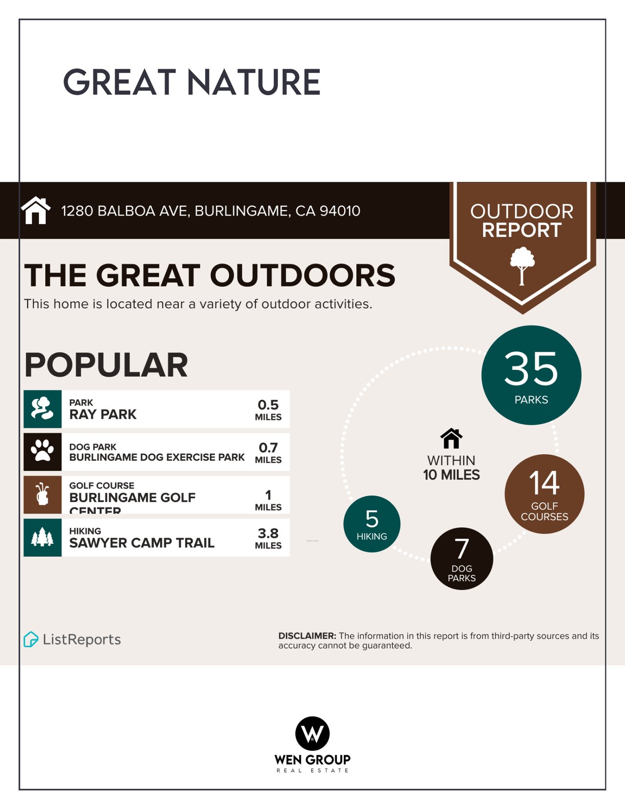
Washington Park is one of Burlingame's central civic landscapes. It is the city's oldest park and occupies land once associated with the Gunst Estate. Tall trees, playing fields, a playground, courts, and picnic areas make it useful for everyday recreation, while the nearby Community Center supports classes and programs throughout the year. Burlingame High School and the historic station are also part of this broader civic neighborhood.
Ray Park and Village Park have a more local scale, especially for residents who visit regularly for play, exercise, or a short outdoor break. Cuernavaca Park, in the northwestern hills, offers playing areas and Bay views from higher elevations. Mills Canyon Wildlife Area has a quieter character: its trail moves through a natural coastal-foothill environment where the landscape and native habitats are the attraction rather than organized sports.
On the eastern side of the city, the Bay Trail and shoreline routes offer a completely different outdoor experience. The water, aircraft views, open sky, and longer paths contrast with the leafy streets west of Highway 101. Nearby Coyote Point Recreation Area, in San Mateo, adds larger waterfront recreation opportunities beyond Burlingame itself. Crossings, road barriers, and trail gaps matter; being near the Bay on a map does not mean every neighborhood has a direct walking route to the shoreline.
Schools, libraries, and community connections
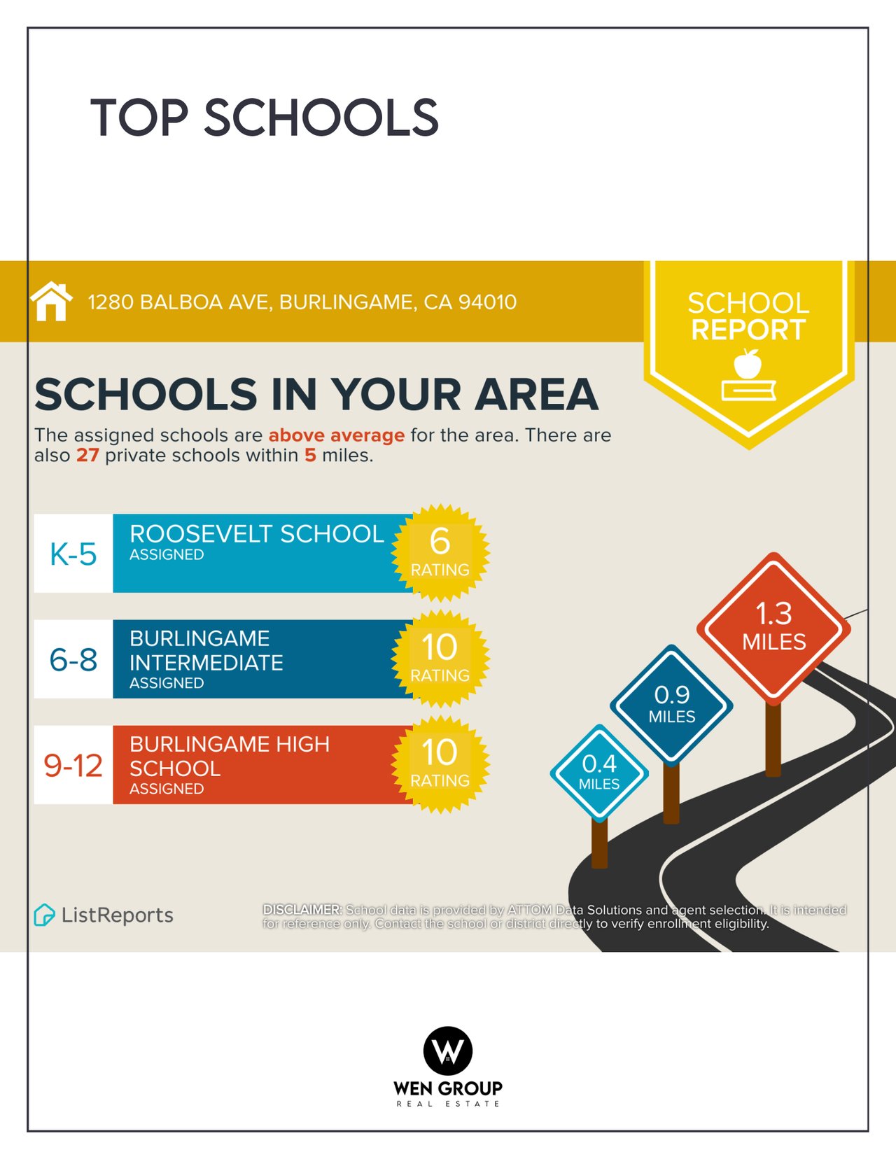
The Burlingame School District operates six elementary schools—Franklin, Hoover, Lincoln, McKinley, Roosevelt, and Washington—and Burlingame Intermediate School. The separate San Mateo Union High School District serves the area at the high-school level, and Burlingame High School is a prominent local landmark. The city also has community education, recreation, and library programs that bring residents together outside the classroom.
School names appear frequently in neighborhood conversations, but the correct school for an individual address should be confirmed with the relevant district. Attendance boundaries, district policies, grade levels, capacity, and high-school assignments are not determined by a neighborhood label or the fact that a building is nearby. School experiences are also more varied than any single ranking can capture.
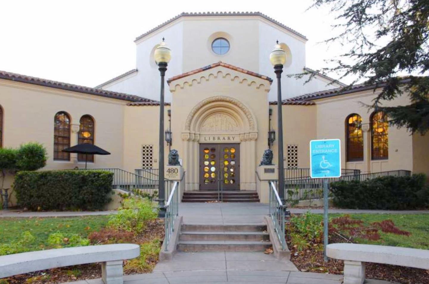
The Burlingame Public Library, the Easton branch library, Washington Park, neighborhood school activities, and public recreation programs all contribute to the city's social fabric. For long-time homeowners and newer residents alike, these familiar places often become the settings where a city begins to feel like a community.
Getting around: Caltrain, roads, and airport proximity
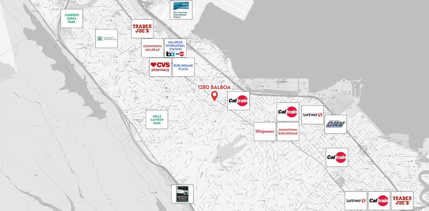
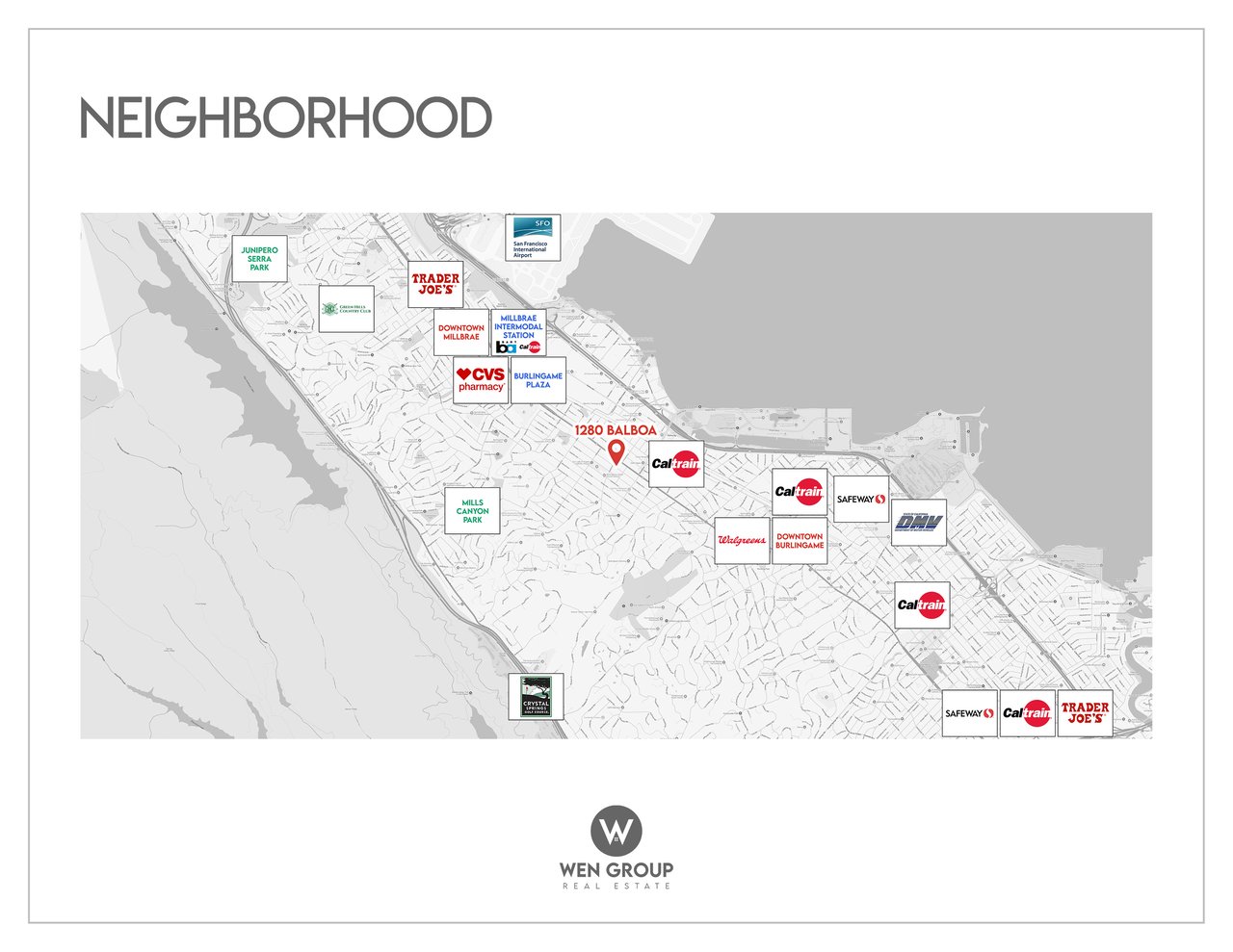
Burlingame has a Caltrain station at its historic downtown depot, which helps connect the city with San Francisco and communities farther south. Broadway has a separate Caltrain station near the northern shopping district; at the time of this draft, Caltrain lists Broadway as weekend-only, so its service should not be treated as equivalent to the downtown station. BART does not have a station in Burlingame; the nearby Millbrae transit center provides the regional BART connection.
Highway 101, Interstate 280, and El Camino Real serve different parts of the city, and San Francisco International Airport is close by. The convenience is real, but so are the differences among neighborhoods. On a compact central street, walking to restaurants or transit may be comfortable. In the hills, grades and the first part of a journey can change that experience. Traffic, train activity, and aircraft sound vary substantially by location, building materials, windows, and flight conditions.
Many residents also travel between Burlingame and neighboring Millbrae, Hillsborough, San Mateo, and San Bruno for work, errands, school programs, or recreation. In daily life, city boundaries are less important than the routes people actually use. For anyone considering a change in routine or a home improvement, practical details such as walkability, street access, and noise control deserve as much attention as a broad regional map.
Climate, light, and the landscape of home
Burlingame has a mild, coastal-influenced Mediterranean climate, with generally dry summers and wetter winters. Its weather is shaped by nearby San Francisco Bay, marine air, and the rising terrain to the west. Fog, breezes, and the timing of afternoon sun can feel different on a sheltered street, in an exposed hillside garden, or along the shoreline.
The local urban forest changes the experience of weather, too. Mature trees create welcome summer shade and a distinctive streetscape, but a tree canopy can also change daylight inside a home, garden growth, and the upkeep of roofs and drainage systems. On a hillside, the angle of the property and the shape of outdoor terraces matter. Near the Bayfront, low-lying land brings a separate set of flood and sea-level-rise considerations that the city addresses through planning. None of those conditions should be generalized to every residential parcel.
Architecture, renovation, and the value of keeping a neighborhood recognizable
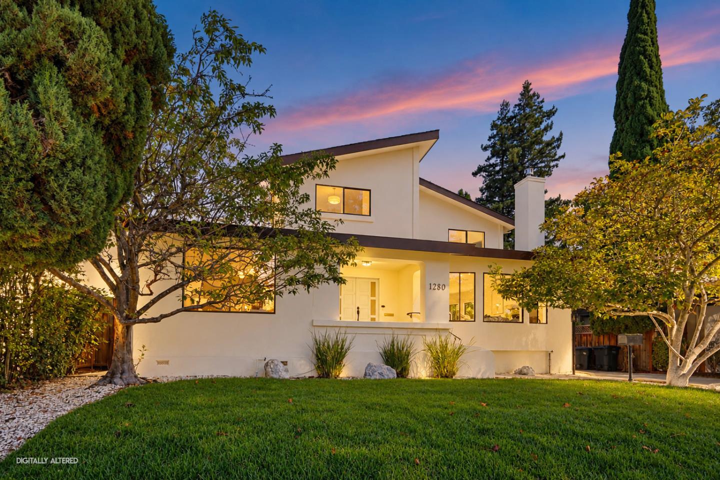
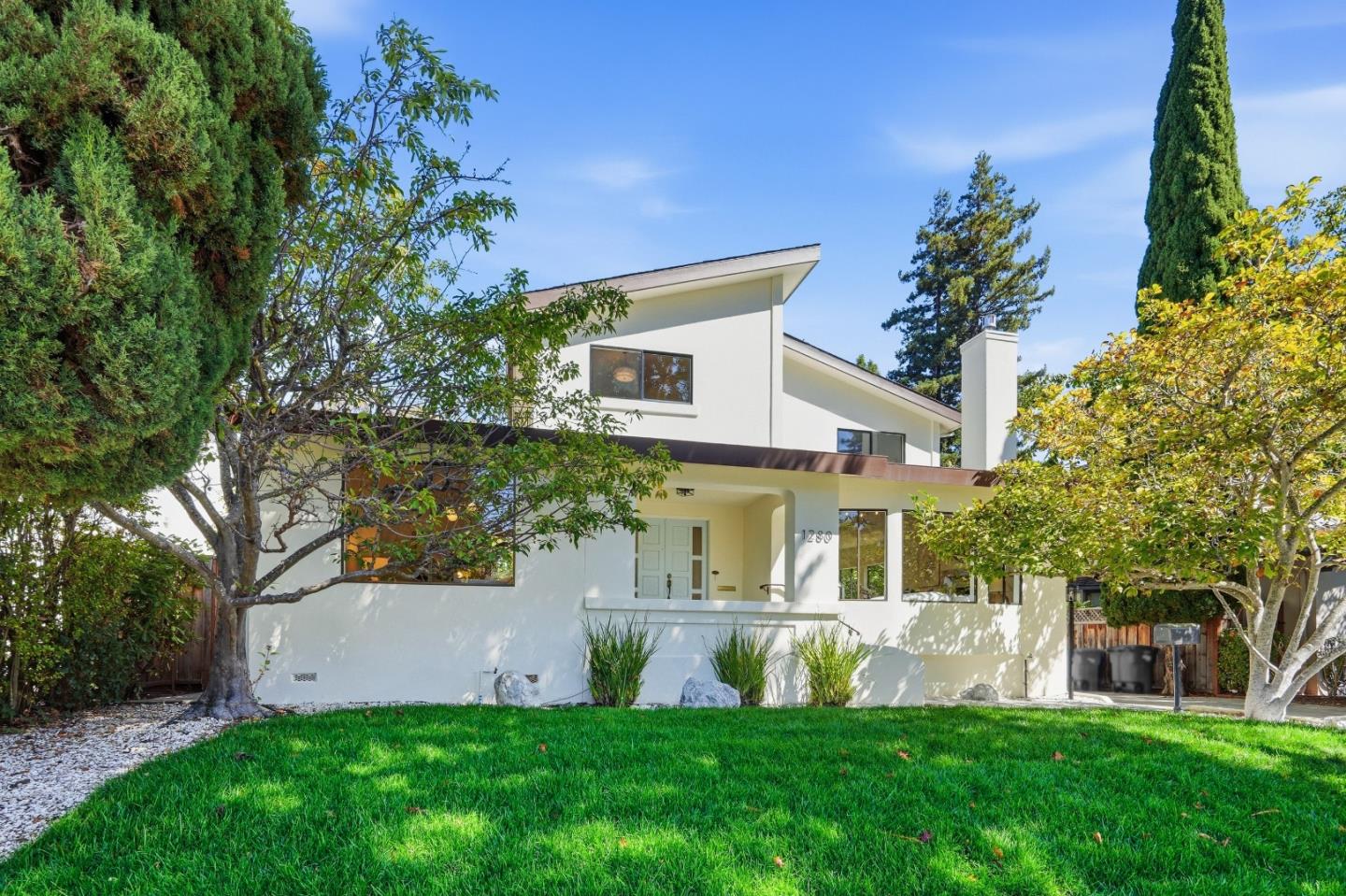
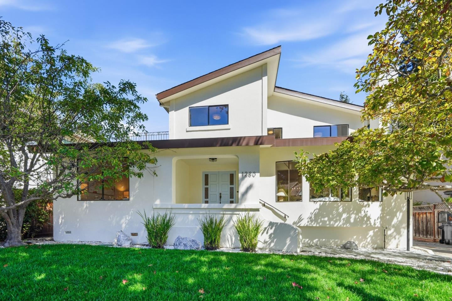
One of Burlingame's distinguishing qualities is the coexistence of many house types. Early twentieth-century homes may be defined by a carefully composed façade, a porch, a tiled roof, or detailed trim. Mid-century homes may have broader windows, lower rooflines, and a closer physical connection to a terrace or garden. Later remodels can improve function while either preserving or dramatically altering that original design language.
For existing homeowners, good architectural decisions often begin by understanding what already works: the orientation of rooms, the proportion of the house to its lot, existing trees, natural light, and the way neighbors' houses relate to one another. Expanding a home without considering those relationships can change the character of a street as much as it changes the house itself. Burlingame's neighborhood design guidance emphasizes building placement, roofs, massing, privacy, and landscaping in the context of surrounding homes.
The city also maintains historic-preservation resources. An older structure is not automatically designated historic, but individual properties may warrant a closer review before significant changes. Permit records, design-review requirements, tree protections, construction condition, and the actual scope of past work matter much more than assumptions based on the age or style of a listing. These observations are relevant to people maintaining a long-held property, planning renovations, or simply appreciating the architecture around them.
The real estate perspective: mature neighborhoods and an uncommon walkable lifestyle
Burlingame's real estate appeal is built around an unusual combination for a Peninsula city: established residential architecture, mature trees, two active shopping districts, Caltrain access, and proximity to San Francisco and SFO. The ability to walk to Burlingame Avenue, Broadway, a park, or the historic station may be a central part of what gives an address its character. In other areas, a larger house, a quieter street, a private garden, or a hillside setting is the more meaningful attraction. The value proposition changes with the neighborhood rather than following one formula across the city.
Older houses can carry qualities that are difficult to reproduce: streetscape proportions, original architectural details, established landscaping, and a sense of continuity with neighboring buildings. But age also brings real maintenance and renovation questions. An extensively rebuilt house may be desirable for its modern function, while a sensitively preserved home may appeal for a different set of reasons. Site layout, privacy, tree protection, building condition, and applicable review requirements can all influence the result of improvements.
The Bayfront, central rail corridor, and western hills belong to distinct property settings. Commute convenience, aircraft or train noise, flood-related considerations in low-lying areas, and grade or drainage in the hills can all matter at the property level. Strong regional access or a celebrated neighborhood name does not make every home equally valuable or immune to market cycles. For existing homeowners and prospective sellers, identifying the architectural and location qualities that are genuinely distinctive is more useful than relying on broad Peninsula price claims.
How Burlingame continues to change
While established residential streets help define Burlingame's identity, the city is not static. Planning efforts address downtown, Broadway, mixed-use corridors, housing needs, and the Bayfront, where hotels, employment, transportation, and waterfront access create a different urban environment. Highway 101 and the railroad form important physical divisions, so improving connections among destinations remains an ongoing challenge.
Potential change in a planning document is not the same as an approved or completed project. Residents and owners can follow current city planning records for proposals that affect specific blocks. The enduring question is how Burlingame accommodates new needs while caring for the trees, historic architecture, parks, and neighborhood scale that make it recognizable.
Questions people ask about Burlingame
What is different about Burlingame Avenue and Broadway?
Burlingame Avenue is the larger downtown destination, with a broad mix of dining, shopping and civic activity around the historic station. Broadway is a more compact neighborhood-oriented district, connected to residential streets in the northern part of town. Both are valuable social places, but their scale and the housing blocks around them feel different.
Does Broadway Caltrain have the same service as Burlingame Station?
No. When this guide was drafted, Caltrain listed Broadway as a weekend-only station, whereas the downtown Burlingame station had a different service pattern. Riders should check current schedules before choosing a route or planning a daily commute. A city with two station locations does not automatically provide identical rail access from both.
How do Easton Addition and Burlingame Hills differ architecturally?
Easton Addition is associated with early residential development and a mix of traditional styles, mature gardens and later replacements. In Burlingame Hills, postwar houses, split levels, grades and view-oriented layouts become more prominent. Roof shape, sunlight, private outdoor space and the way a building fits its street are part of each area's design character.
What matters when selling a classic Burlingame home?
An effective listing can explain why the architecture belongs in its setting: original features, a well-designed renovation, mature landscaping, walkable destinations and the condition of major systems. Wen Group's architecture-informed approach helps distinguish historic character from cosmetic age while using verified permits, preservation rules and neighborhood comparables.
What makes Burlingame feel like home
Burlingame cannot be summed up by a single downtown, one celebrated neighborhood, or one type of house. It is the combination that matters: a Mission Revival train station, the small rituals of the Fresh Market, meals on Broadway, evenings on Burlingame Avenue, mature neighborhood trees, traditional homes, mid-century hillsides, and the open space of canyon and bayfront trails.
For some people, the pleasure of living here comes from walking to a favorite café. For others, it is the quiet of an established street, a park woven into daily routines, or the architectural details of a home that has been cared for across generations. Burlingame's neighborhoods each express a different part of its story. Getting to know those differences is what gives this small Peninsula city such a strong sense of place.
Living in Burlingame: two downtowns, leafy streets, and a strong sense of placeBurlingame is one of the Peninsula cities whose identity becomes clearer the more time you spend on its streets. Its central neighborhoods are shaded by mature trees and shaped by homes from different architectural eras. Its commercial life revolves around two distinctly different destinations: the busier, longer stretch of Burlingame Avenue and the more compact Broadway district to the north. Beyond them, residential roads climb toward open-space canyons and hillside neighborhoods, while the city extends east across Highway 101 toward San Francisco Bay.
Daily life moves among those settings. A weekend might include a farmers' market visit, a walk past the historic train station, lunch with friends on Burlingame Avenue, and an afternoon at Washington Park. Another day might begin on a hillside trail at Mills Canyon or with a short stop at the stores on Broadway. The same city offers compact blocks near shops and Caltrain, established single-family streets, apartments and condominiums, and homes where slope and views change the relationship between rooms and gardens.
Burlingame's appeal is not simply its location between San Francisco and Silicon Valley. Its history, urban forest, local institutions, and housing stock give neighborhoods identities that do not disappear at the city boundary. Understanding how each part developed helps explain why a house near Broadway does not feel like one near downtown, and why a low-profile home in Mills Estates can be architecturally different from a period house in Easton Addition.
A history of estates, railroads, and the City of TreesLong before the city existed, this part of the Peninsula was home to Indigenous Ohlone communities. In the nineteenth century, land associated with Rancho Buri Buri and later large private estates shaped the area. The Howard family, the Easton family, and other estate owners left traces in place names and street patterns. The city also takes its name from Anson Burlingame, the American diplomat and former U.S. minister to China, who acquired land in the area during the 1860s.
The railroad helped turn estate country into a permanent town. Burlingame's station opened in 1894, its Mission Revival architecture making it a landmark in its own right. The building's tower, arched details, and historic roof design are more than a nostalgic backdrop; they show how architecture was used to give an emerging community a public identity. Burlingame incorporated in 1908, and the neighboring Easton area was annexed soon after.
The 1906 San Francisco earthquake and fires encouraged more residents to settle along the Peninsula. Early subdivisions spread around the rail corridor, and later decades brought homes that reflected changing design tastes and the expansion of suburban life. The city now contains Craftsman and Spanish-influenced houses, traditional revival styles, postwar ranch homes, hillside split-levels, and contemporary replacements. These layers are visible block by block instead of being confined to one historic district.
Burlingame's nickname, the City of Trees, also has a real landscape history. The Howard–Ralston tree rows along El Camino Real were planted in the 1870s, initially with elms and eucalyptus used to protect young trees from wind. Today the historic rows, neighborhood trees, and park landscapes remain important elements of the city's character. Trees add shade and texture, but their long-term care—roots, canopy, safety, and infrastructure—is part of a changing urban environment.
A closer look at Burlingame's neighborhoodsBurlingame is best understood as a set of places with different histories, building patterns, and relationships to downtown or the hills. Community names such as Easton Addition, Burlingame Park, Ray Park, and Burlingame Hills are commonly used, while mapping systems and real estate reporting boundaries sometimes combine or divide them differently. The following descriptions focus on recognizable character rather than suggesting that every house within a label looks or lives the same way.
Easton Addition: architectural variety and established streetsEaston Addition occupies a central place in Burlingame's early residential history. The name comes from the Easton family's former estate and the subdivisions that followed. Many streets have a distinctly traditional feel, with mature landscaping, sidewalks, and houses showing the design vocabulary of the early twentieth century. Craftsman details, stucco façades, pitched roofs, entry porches, and later period-inspired homes can appear within a short walk of one another.
The visual rhythm of the neighborhood often comes from the combination of rooflines, front gardens, windows, and the proportion of a house to its lot. Some homes have been carefully updated behind their original façades; others have undergone substantial additions or replacement construction. That architectural variety makes the neighborhood interesting to explore even without a destination. It also means the relationship between a new design and its neighboring buildings can be as important as the interior finish.
Easton Addition stretches across different positions relative to Broadway, El Camino Real, and the western residential areas, so everyday access varies within the name. The historic subdivision story unifies it, but one address may be much closer to a café or train platform while another feels more removed from commercial activity.
Burlingame Park: early residential character near downtownBurlingame Park reflects another chapter of the city's original estate and subdivision era. Its established streets and older homes give it a different architectural atmosphere from later postwar neighborhoods. Traditional designs, mature trees, garden setbacks, and individual houses of varying scale contribute to the sense that the neighborhood grew over time rather than arriving as a single uniform development.
Its location in the broader downtown area places parks, schools, and the Burlingame Avenue district within the everyday geography of many residents, although distances and walking conditions are specific to each block. Washington Park and the civic facilities near it provide a particularly important point of reference. As with other historic neighborhoods, restoration, renovation, and new construction may look very different from property to property.
Burlingame Terrace and Burlingame Gardens: close to the city's two commercial districtsBurlingame Terrace and Burlingame Gardens contribute to the more compact and accessible residential fabric around the central and northern commercial corridors. The mix of houses, apartments, and remodeled properties differs from the spacious, view-oriented hillside settings. Residential blocks connect to places where errands, restaurants, and everyday services are part of the neighborhood rather than a separate trip across town.
Burlingame Gardens has a particularly strong relationship with the Broadway area. Some streets feel sheltered and residential even though the commercial district is close by; others are more directly affected by traffic and transportation routes. Burlingame Terrace, nearer the central city, contains its own combinations of older housing, small-scale streets, and later alterations. The experience of a home near a train line or major road can be quite different from that of a home only a few blocks away.
Ray Park, Burlingame Village, and Burlingame Gate: northern neighborhood routinesIn northern Burlingame, Ray Park, Burlingame Village, and Burlingame Gate are useful neighborhood references, each with its own street layout and relationship to schools, shops, and open spaces. Here the city includes many twentieth-century houses, properties updated in phases, and streets where a familiar park or neighborhood commercial area becomes the center of daily routines. The architecture is not one single style, and it is worth noticing roof forms, additions, setbacks, and how private gardens meet the street.
Ray Park itself anchors an active outdoor scene with playground space, courts, playing areas, and places to gather. Village Park, nearer California Drive, is another neighborhood-scale destination with a preschool program and casual recreational space. A home may be close to one of these parks yet have a very different route to Broadway or a rail stop. These small differences help define neighborhood life without reducing it to a commute calculation.
Burlingame Hills and Mills Estates: mid-century houses and the western landscapeThe western hills reveal a different side of Burlingame. Burlingame Hills and Mills Estates include postwar residential landscapes with ranch houses, split levels, and some homes showing Eichler-influenced design. Roof pitches, window placement, exposed beams, and the relationship between interior living spaces and outdoor terraces often tell a mid-century architectural story. Remodels and larger replacements add another layer of change.
Topography matters here. A road can rise and curve, entrances may meet a sloped site at different levels, and sunlight or views depend strongly on orientation. Gardens may occupy a single level, a terrace, or several connected areas. Retaining walls, drainage, trees, garage placement, and the accessibility of outdoor space all influence how a property works. The size of a lot alone cannot fully describe the everyday experience of a hillside home.
Mills Canyon Wildlife Area, Cuernavaca Park, and western parkland help define the nearby recreational geography. The hills can feel far from the commercial bustle even though downtown and regional routes remain part of the same city. Millbrae also has a neighborhood called Mills Estates, so city limits and individual property locations should be checked rather than assuming a shared neighborhood name identifies one jurisdiction.
Lyon Hoag, Oak Grove Manor, and the neighborhoods around the rail corridorThe southeastern and central neighborhoods known as Lyon Hoag and Oak Grove Manor show Burlingame's relationship with its older grid, the railroad, and nearby civic and commercial destinations. A mix of property ages and housing types creates a more varied scale than the largely detached-home sections of the western hills. Around the rail corridor and the station, the ability to reach downtown on foot can be part of the appeal of everyday life.
The closeness of these districts to commercial activity also introduces practical differences in sound, street parking, and pedestrian traffic. One tree-shaded residential block can feel calm while a nearby street plays an important role in regional movement. Rather than making blanket assumptions, each area is best understood by the way its homes and shared public spaces meet actual roads and destinations.
Downtown and Burlingame Square: life around the historic stationDowntown is not just a shopping address. Its blocks combine historic commercial buildings, restaurants, civic destinations, offices, apartments, and other housing close to the Burlingame station. Burlingame Square and the historic depot connect today's daily routines to the town's railroad origins. The station building itself is an architectural landmark, while the streets leading toward Burlingame Avenue reflect the older pattern of a compact commercial center.
For some residents, this is the pleasure of living where a coffee shop, a library visit, a train platform, and an evening meal can fit into the same walk. For others, nearby activity, parking patterns, and smaller homes are trade-offs worth considering. The neighborhood's defining feature is the relationship between the home and its public setting—not a particular house size or price band.
Two distinct main streets: Burlingame Avenue and BroadwayBurlingame Avenue is the city's principal downtown destination. Between California Drive and El Camino Real, it brings together cafés, restaurants, independent shops, national brands, and streets that invite browsing. Its historic commercial buildings, broad sidewalks, and outdoor seating create a more animated setting than many conventional suburban shopping centers. The neighboring streets add more dining, services, and everyday errands, while the library and Washington Park extend the experience beyond retail.
Broadway is different by design and by feeling. Its shorter stretch between California Drive and El Camino Real is more of a neighborhood main street: restaurants, bakeries, smaller shops, local services, and familiar storefronts. The historic Broadway arch gives the district a recognizable entrance, and its connection to Easton-era development is part of the city's own history. Broadway is not a smaller copy of Burlingame Avenue; it has a more intimate pace and serves a different collection of nearby residential streets.
Burlingame Plaza provides another practical shopping point in the city's north, while the Bayfront supports hotels and restaurants serving visitors as well as residents. Food choices are varied across town, from casual neighborhood breakfasts and cafés to international dining and more formal evenings out. Specific restaurants come and go, but the value of having two established, walkable commercial districts is part of what makes Burlingame's local life distinctive.
The Burlingame Fresh Market brings produce and other market goods into the downtown routine, with a year-round Sunday market and seasonal weekday hours according to the county's published listing. Local street events and community programming also make downtown a gathering place, not only a place to shop. Schedules and participating vendors should be checked as they change.
Parks, trails, and the difference between hillside and bayfrontWashington Park is one of Burlingame's central civic landscapes. It is the city's oldest park and occupies land once associated with the Gunst Estate. Tall trees, playing fields, a playground, courts, and picnic areas make it useful for everyday recreation, while the nearby Community Center supports classes and programs throughout the year. Burlingame High School and the historic station are also part of this broader civic neighborhood.
Ray Park and Village Park have a more local scale, especially for residents who visit regularly for play, exercise, or a short outdoor break. Cuernavaca Park, in the northwestern hills, offers playing areas and Bay views from higher elevations. Mills Canyon Wildlife Area has a quieter character: its trail moves through a natural coastal-foothill environment where the landscape and native habitats are the attraction rather than organized sports.
On the eastern side of the city, the Bay Trail and shoreline routes offer a completely different outdoor experience. The water, aircraft views, open sky, and longer paths contrast with the leafy streets west of Highway 101. Nearby Coyote Point Recreation Area, in San Mateo, adds larger waterfront recreation opportunities beyond Burlingame itself. Crossings, road barriers, and trail gaps matter; being near the Bay on a map does not mean every neighborhood has a direct walking route to the shoreline.
Schools, libraries, and community connectionsThe Burlingame School District operates six elementary schools—Franklin, Hoover, Lincoln, McKinley, Roosevelt, and Washington—and Burlingame Intermediate School. The separate San Mateo Union High School District serves the area at the high-school level, and Burlingame High School is a prominent local landmark. The city also has community education, recreation, and library programs that bring residents together outside the classroom.
School names appear frequently in neighborhood conversations, but the correct school for an individual address should be confirmed with the relevant district. Attendance boundaries, district policies, grade levels, capacity, and high-school assignments are not determined by a neighborhood label or the fact that a building is nearby. School experiences are also more varied than any single ranking can capture.
The Burlingame Public Library, the Easton branch library, Washington Park, neighborhood school activities, and public recreation programs all contribute to the city's social fabric. For long-time homeowners and newer residents alike, these familiar places often become the settings where a city begins to feel like a community.
Getting around: Caltrain, roads, and airport proximityBurlingame has a Caltrain station at its historic downtown depot, which helps connect the city with San Francisco and communities farther south. Broadway has a separate Caltrain station near the northern shopping district; at the time of this draft, Caltrain lists Broadway as weekend-only, so its service should not be treated as equivalent to the downtown station. BART does not have a station in Burlingame; the nearby Millbrae transit center provides the regional BART connection.
Highway 101, Interstate 280, and El Camino Real serve different parts of the city, and San Francisco International Airport is close by. The convenience is real, but so are the differences among neighborhoods. On a compact central street, walking to restaurants or transit may be comfortable. In the hills, grades and the first part of a journey can change that experience. Traffic, train activity, and aircraft sound vary substantially by location, building materials, windows, and flight conditions.
Many residents also travel between Burlingame and neighboring Millbrae, Hillsborough, San Mateo, and San Bruno for work, errands, school programs, or recreation. In daily life, city boundaries are less important than the routes people actually use. For anyone considering a change in routine or a home improvement, practical details such as walkability, street access, and noise control deserve as much attention as a broad regional map.
Climate, light, and the landscape of homeBurlingame has a mild, coastal-influenced Mediterranean climate, with generally dry summers and wetter winters. Its weather is shaped by nearby San Francisco Bay, marine air, and the rising terrain to the west. Fog, breezes, and the timing of afternoon sun can feel different on a sheltered street, in an exposed hillside garden, or along the shoreline.
The local urban forest changes the experience of weather, too. Mature trees create welcome summer shade and a distinctive streetscape, but a tree canopy can also change daylight inside a home, garden growth, and the upkeep of roofs and drainage systems. On a hillside, the angle of the property and the shape of outdoor terraces matter. Near the Bayfront, low-lying land brings a separate set of flood and sea-level-rise considerations that the city addresses through planning. None of those conditions should be generalized to every residential parcel.
Architecture, renovation, and the value of keeping a neighborhood recognizableOne of Burlingame's distinguishing qualities is the coexistence of many house types. Early twentieth-century homes may be defined by a carefully composed façade, a porch, a tiled roof, or detailed trim. Mid-century homes may have broader windows, lower rooflines, and a closer physical connection to a terrace or garden. Later remodels can improve function while either preserving or dramatically altering that original design language.
For existing homeowners, good architectural decisions often begin by understanding what already works: the orientation of rooms, the proportion of the house to its lot, existing trees, natural light, and the way neighbors' houses relate to one another. Expanding a home without considering those relationships can change the character of a street as much as it changes the house itself. Burlingame's neighborhood design guidance emphasizes building placement, roofs, massing, privacy, and landscaping in the context of surrounding homes.
The city also maintains historic-preservation resources. An older structure is not automatically designated historic, but individual properties may warrant a closer review before significant changes. Permit records, design-review requirements, tree protections, construction condition, and the actual scope of past work matter much more than assumptions based on the age or style of a listing. These observations are relevant to people maintaining a long-held property, planning renovations, or simply appreciating the architecture around them.
The real estate perspective: mature neighborhoods and an uncommon walkable lifestyleBurlingame's real estate appeal is built around an unusual combination for a Peninsula city: established residential architecture, mature trees, two active shopping districts, Caltrain access, and proximity to San Francisco and SFO. The ability to walk to Burlingame Avenue, Broadway, a park, or the historic station may be a central part of what gives an address its character. In other areas, a larger house, a quieter street, a private garden, or a hillside setting is the more meaningful attraction. The value proposition changes with the neighborhood rather than following one formula across the city.
Older houses can carry qualities that are difficult to reproduce: streetscape proportions, original architectural details, established landscaping, and a sense of continuity with neighboring buildings. But age also brings real maintenance and renovation questions. An extensively rebuilt house may be desirable for its modern function, while a sensitively preserved home may appeal for a different set of reasons. Site layout, privacy, tree protection, building condition, and applicable review requirements can all influence the result of improvements.
The Bayfront, central rail corridor, and western hills belong to distinct property settings. Commute convenience, aircraft or train noise, flood-related considerations in low-lying areas, and grade or drainage in the hills can all matter at the property level. Strong regional access or a celebrated neighborhood name does not make every home equally valuable or immune to market cycles. For existing homeowners and prospective sellers, identifying the architectural and location qualities that are genuinely distinctive is more useful than relying on broad Peninsula price claims.
How Burlingame continues to changeWhile established residential streets help define Burlingame's identity, the city is not static. Planning efforts address downtown, Broadway, mixed-use corridors, housing needs, and the Bayfront, where hotels, employment, transportation, and waterfront access create a different urban environment. Highway 101 and the railroad form important physical divisions, so improving connections among destinations remains an ongoing challenge.
Potential change in a planning document is not the same as an approved or completed project. Residents and owners can follow current city planning records for proposals that affect specific blocks. The enduring question is how Burlingame accommodates new needs while caring for the trees, historic architecture, parks, and neighborhood scale that make it recognizable.
Questions people ask about BurlingameWhat is different about Burlingame Avenue and Broadway?Burlingame Avenue is the larger downtown destination, with a broad mix of dining, shopping and civic activity around the historic station. Broadway is a more compact neighborhood-oriented district, connected to residential streets in the northern part of town. Both are valuable social places, but their scale and the housing blocks around them feel different.Does Broadway Caltrain have the same service as Burlingame Station?No. When this guide was drafted, Caltrain listed Broadway as a weekend-only station, whereas the downtown Burlingame station had a different service pattern. Riders should check current schedules before choosing a route or planning a daily commute. A city with two station locations does not automatically provide identical rail access from both.How do Easton Addition and Burlingame Hills differ architecturally?Easton Addition is associated with early residential development and a mix of traditional styles, mature gardens and later replacements. In Burlingame Hills, postwar houses, split levels, grades and view-oriented layouts become more prominent. Roof shape, sunlight, private outdoor space and the way a building fits its street are part of each area's design character.What matters when selling a classic Burlingame home?An effective listing can explain why the architecture belongs in its setting: original features, a well-designed renovation, mature landscaping, walkable destinations and the condition of major systems. Wen Group's architecture-informed approach helps distinguish historic character from cosmetic age while using verified permits, preservation rules and neighborhood comparables.What makes Burlingame feel like homeBurlingame cannot be summed up by a single downtown, one celebrated neighborhood, or one type of house. It is the combination that matters: a Mission Revival train station, the small rituals of the Fresh Market, meals on Broadway, evenings on Burlingame Avenue, mature neighborhood trees, traditional homes, mid-century hillsides, and the open space of canyon and bayfront trails.
For some people, the pleasure of living here comes from walking to a favorite café. For others, it is the quiet of an established street, a park woven into daily routines, or the architectural details of a home that has been cared for across generations. Burlingame's neighborhoods each express a different part of its story. Getting to know those differences is what gives this small Peninsula city such a strong sense of place.